Friend of the blog Peter A shares his some of his Irish campaign experiences from Kinsale 1690....
The Fort – Kinsale
Kinsale at 7.30am on a Sunday morning. Clear, bright, cold.
Sun rising over the remains of the old James Fort. The harbour still and quiet
– waiting for the day.

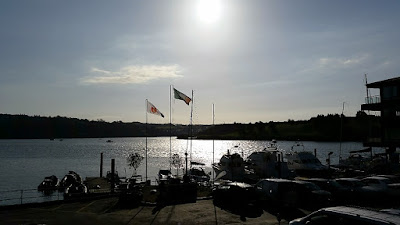
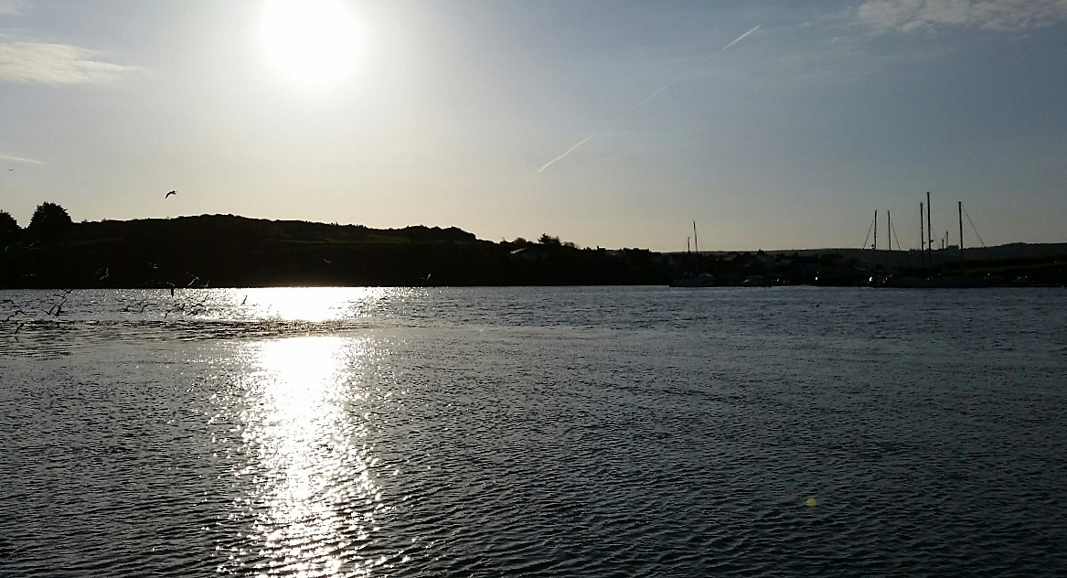

That peace – an enchanted moment – the sea and the shape of
the hills is a view untouched for a thousand years – any modern intrusions fade
away - what we see today is what they saw in 1690.
And the memories of that time flood back… the old Fort was
taken by the Dane General Tettau at the head of 800 men. The garrison was far
more numerous than had been reported by deserters – suggesting only 150 men. In
fact, there were 450 but as the assault went in an explosion amongst the
barrels of powder killed many of the defenders and the Fort was quickly carried
– 220 Irish were killed and the rest made prisoners… some tried to escape
across the water in boats to the New Fort. But the tide was against them and
shot from the shore despatched most of them.
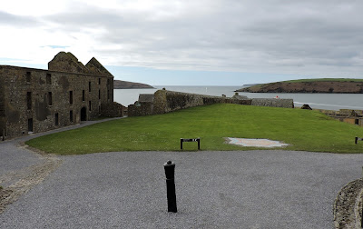
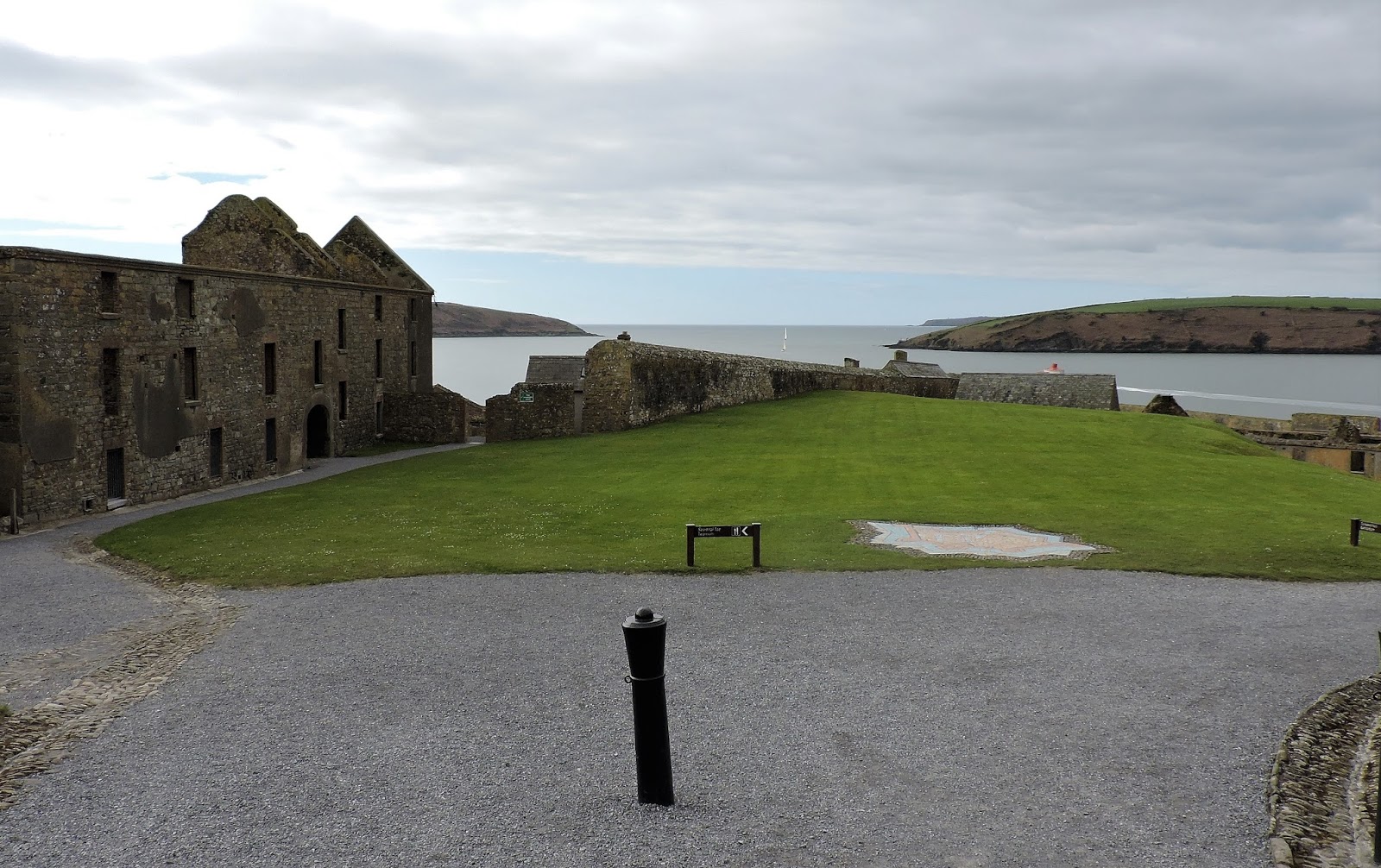
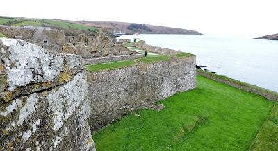
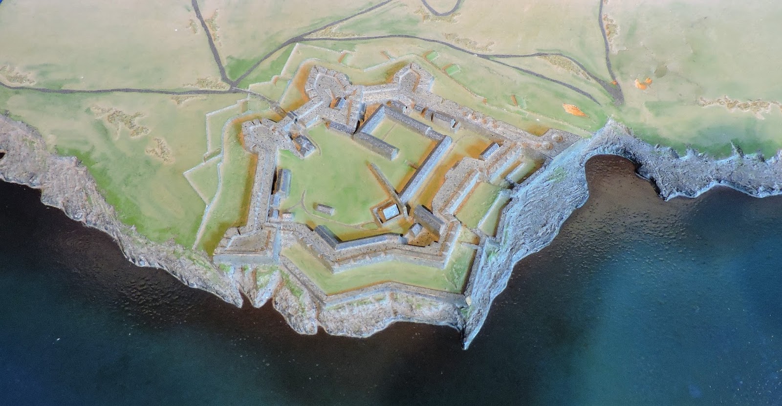
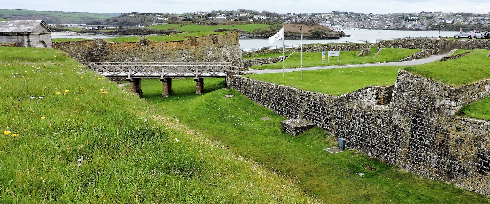
And so to Charles Fort. The new Fort. One of the best-preserved
star Forts in Europe. It followed the principles of Vauban in terms of the
ramparts, the bastions and the covered way. However, it was adapted to the
uneven topography of the site and its principal role was seen as a coastal
defence Fortification to prevent foreign naval forces entering Kinsale harbour.
Since sieges rather than field battles were by far the most common form of
conflict in our period, it is exciting to visit a place that witnessed a real
siege in 1690. History seeps out from the massive walls…
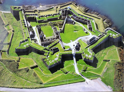

The best way to appreciate the shape and scale of a
Vauban-style Fort is from the sky. This photo hangs in the gatehouse – which
now serves as the entrance to the museum. The white gravel walkway from the
carpark across the bridge to the main gate is at the bottom of the image. The
huge bastions and grassed walkways look strong and not to be easily conquered…
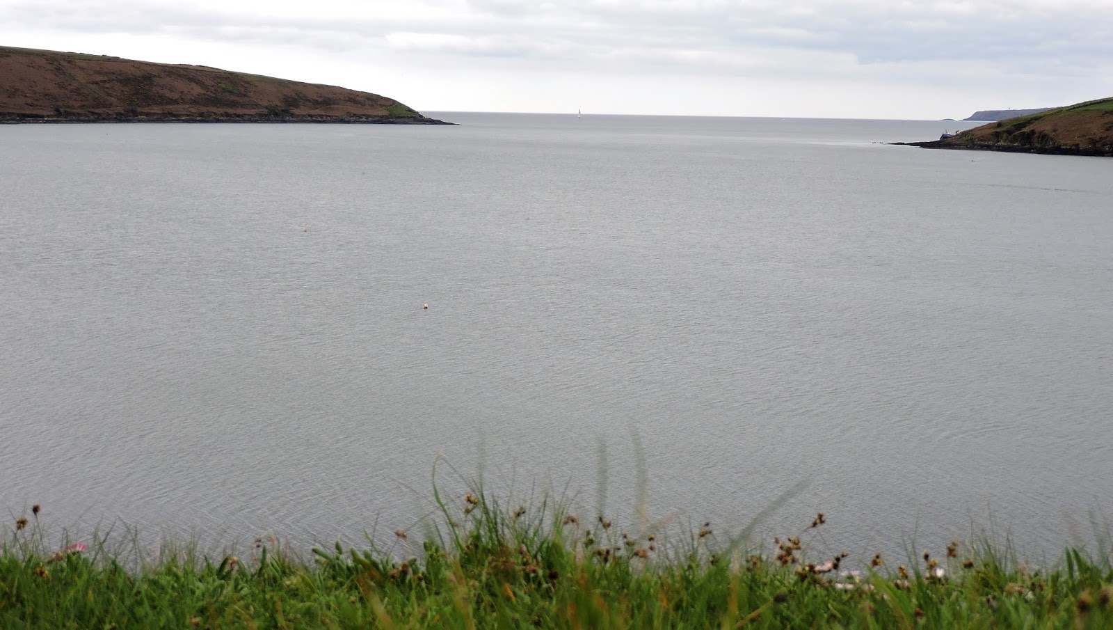
Once inside there are stunning views out to sea. What a vantage
point! Head straight south and you would eventually hit Brest on the Brittany
peninsula and then the Bay of Biscay and Spain. From beyond that horizon, James
first arrived in Ireland here in Kinsale - full of hope and expectation of the
recovery of his English throne.

The sheltered nature of the wonderful deep harbour is clear
– an attractive anchorage for an enemy fleet. When the Fort was built, the
threat was anticipated to come from this sea – essentially from France…! It was
constructed in the early 1680s, and Charles Fort was the most expensive Fortification
in Ireland. William Robinson, Superintendent of Fortifications was the
designer. The Earl of Orrery laid the first stone and when the Lord Lieutenant
of Ireland, the Duke of Ormond visited the site in August 1681, for obvious
diplomatic and sycophantic reasons, he named it after King Charles II.

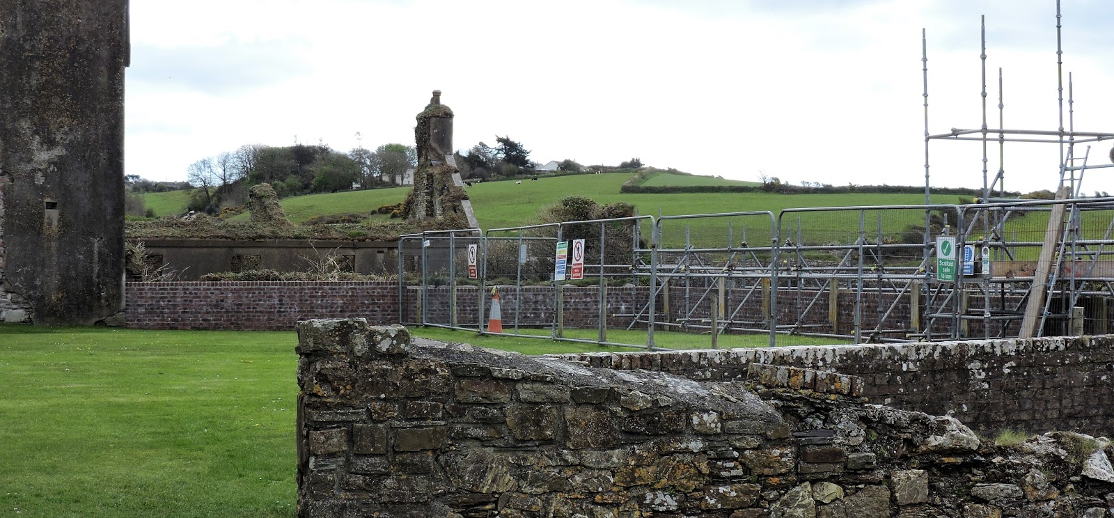
The key weakness of the place - as is seen in these pictures
beyond the scaffolding and the close-up view - is the rising high ground where a besieger could
look down on the Fort, bombard it with cannon and mortars and chose his point
of attack. Despite its seemingly massive strength, the new Fort was in fact
vulnerable to attack from land-based forces.
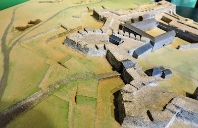
The sheer labour, the danger and difficulty of besieging a Fortification
is brought to life in these models in a display in one of the garrison
buildings.

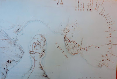

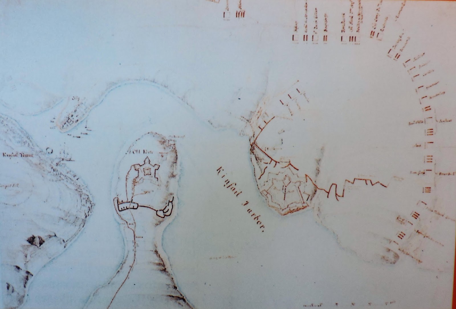
This siege map of the order of battle of the Williamites
forces – attributed to Thomas Philips who did many drawings of Irish harbours
and Fortifications - though frustratingly faint - is a great illustration of
where the troops were camped and where their trenches ran. Philips felt the new Fort was badly-sited
being overlooked by the high ground inland. The English and the Danes prepared
to make two attacks. As we look we see the Danes under the Prince of Württemberg
positioned on the right or East– and the English on the left or West.
After his first success with the taking of James Fort, my
Lord Marlborough now sent a summons to the Governor of the substantial New Fort.
Sir Edward Scott was no pushover. He answered coolly that ‘it would be time
enough to capitulate a month hence…’. Marlborough lacked the necessary siege
equipment and artillery which was on its ponderous way from Cork. Once the
batteries were in place however, the Allies expected to effect a breach in a
few short days…
Trenches were opened and the saps which can be seen in the
jagged red lines - headed steadily towards the counterscarp - while the heavy
cannons were hourly anticipated.


The Danish high ground, the covered way and the Cockpit
bastion
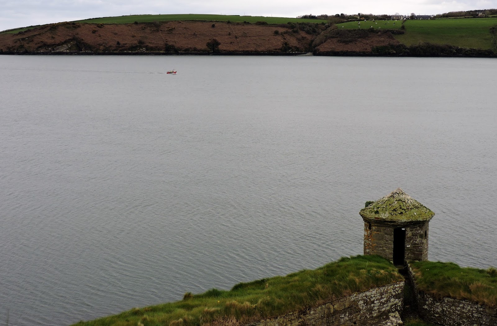
A guerite – a sentry box – one of my favourite Vaubanesque
architectural features!
Here is the high ground where the Danes were encamped. They
sapped from this ground towards the Cockpit or East bastion – aiming to make a
breach in ‘the long wall’ that ran from here to the seaward Charles bastion on
the cliff edge.


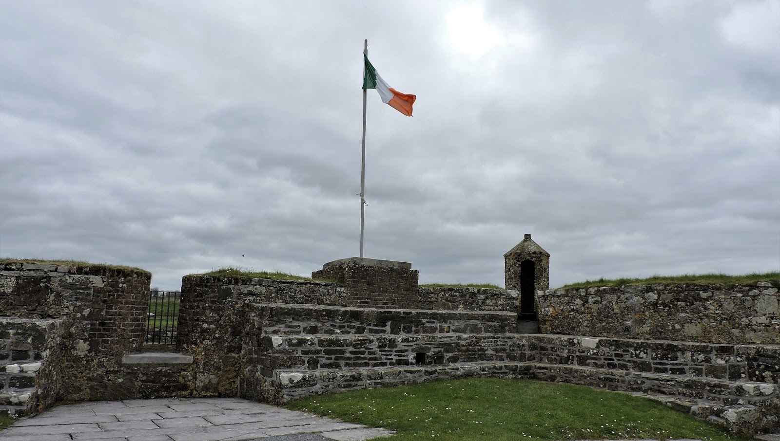

The Irish tricolour – it is April 2016 and
memories and notices referring to the centenary of the Easter Rising are
everywhere. Here is another brick sentry box on the outermost point of the
Flagstaff bastion. Also note the musket firing platforms. The Flagstaff is the
largest bastion and designed to be used as a citadel if needed as a last
refuge.
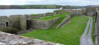

A good view of the gun platform, with the grass ramp up to
the firing position. The area alongside the ramp was used as a parade ground.
The platform has commanding views and just like the casemated seaward facing
Devil’s and Charles bastions, its job was to defend the harbour from enemy
intrusion.
The dénouement came with the arrival of the cannon from Cork
and the establishment of the batteries. A breach capable of being assaulted was
soon made by the Danes in the long East wall in front of them. The saps there
were now in pistol range of the covered way and the troops were ready to
attack. The siege had lasted 13 days and the last 5 days had witnessed
continual cannon fire. Sir Edward now felt that the honours of war had been
satisfied and he opened negotiations with the Earl of Marlborough on surrender.
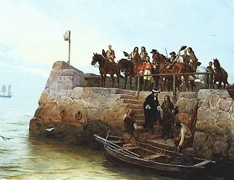
The white flag was raised and the chamade was beaten. Good terms were agreed and the Governor and
his feisty wife Lady Scott led the garrison out through the breach – she in her
coach - with drums beating and flags waving. Twelve hundred survivors marched
out from Fort Charles and headed for Limerick.


the Cockpit bastion. They exited here.
Final views of the Fort, the covered way
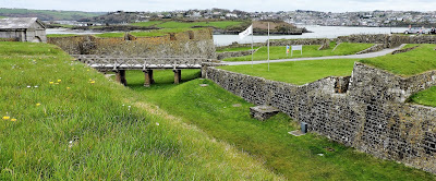
Kinsale in the background. Beyond the bridge and entrance
point across the dry ditch. After the surrender, Brigadier General Churchill,
Marlborough’s brother, became Governor of the Fort.
James Fort is visible on the brown promontory in the middle
distance and the port of Kinsale and its landlocked, deep safe harbour is on
the horizon.
These defeats closed the access to the south of Ireland for
French shipping and support. It was the beginning of the end. James had landed
here in Kinsale in 1689. And now also from here he scuttled away down these
steps and into his lonely boat. ‘ Will ye no come back again…?’
 |
| James leaving Ireland |