Friend of the blog Peter A - wanderings in ancient Ireland – part two
It is along road from Kinsale to Limerick. But much harder
on foot or on horseback than by car. The first tough haul is the twisty,
tortuous undulating road up to Cork – that caused Marlborough’s men so much
trouble in bringing his heavy artillery down to take part in the siege of
Charles Fort, Kinsale.
Once beyond Cork, we head North up the motorway towards
Fermoy and Mitchelstown. On the right on the horizon are the Galty mountains.
To the left is the Ballyhoura chain. Then across country you see miles of the
marshy, boggy landscape that is so common in Ireland. Wild and hard to
cultivate – how to scratch a living here? On we go, past signs for Tipperary,
Hospital, Ballyneety and finally into Limerick.
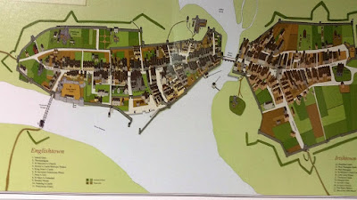
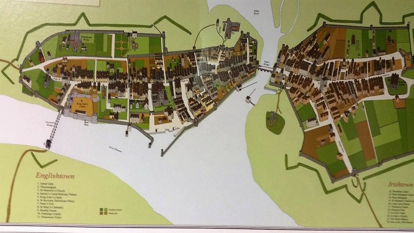
Across Baals bridge over the Abbey river that divides Irish
town and English town and on to King John’s island, the historical heart of the
city.
 |
| King John's Castle |
King John’s castle is massive. Those walls and round towers
were built to intimidate and repel. A first
v view of the River Shannon at the end of the street – how wide, fast-flowing and majestic it is… what an
obstacle to cross…!
v view of the River Shannon at the end of the street – how wide, fast-flowing and majestic it is… what an
obstacle to cross…!
 |
| River Shannon |
Then the view of the modern Thomond Bridge – layer upon
layer of history all around – tread softly…
 |
| Thomond Bridge |
The castle museum is superbly done. A multi-media experience
- as is the fashion these days - with sounds and lights and characters from
Limerick’s history who talk to you on the press of a button. ..
A journey through time from the Vikings, the original ‘English
Lords’, the medieval clashes, the Plantations, the Civil War and then to our
period, the sieges and great dispute between the Williamites and the Jacobites
which was concluded (for a time) here.
In the museum is a wonderful huge model of Limerick as it
would have been around 1690. This bird’s eye view shows the city walls, the Castle
of King John, St Mary’s cathedral, the Thomond bridge and the river Shannon.
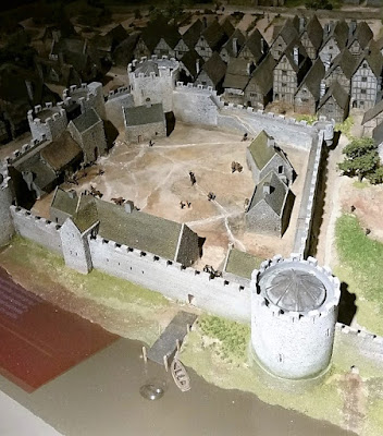


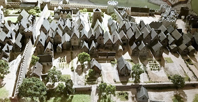


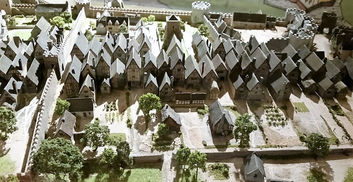
The Limerick model – Castle and St Mary’s and the English Town
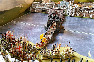
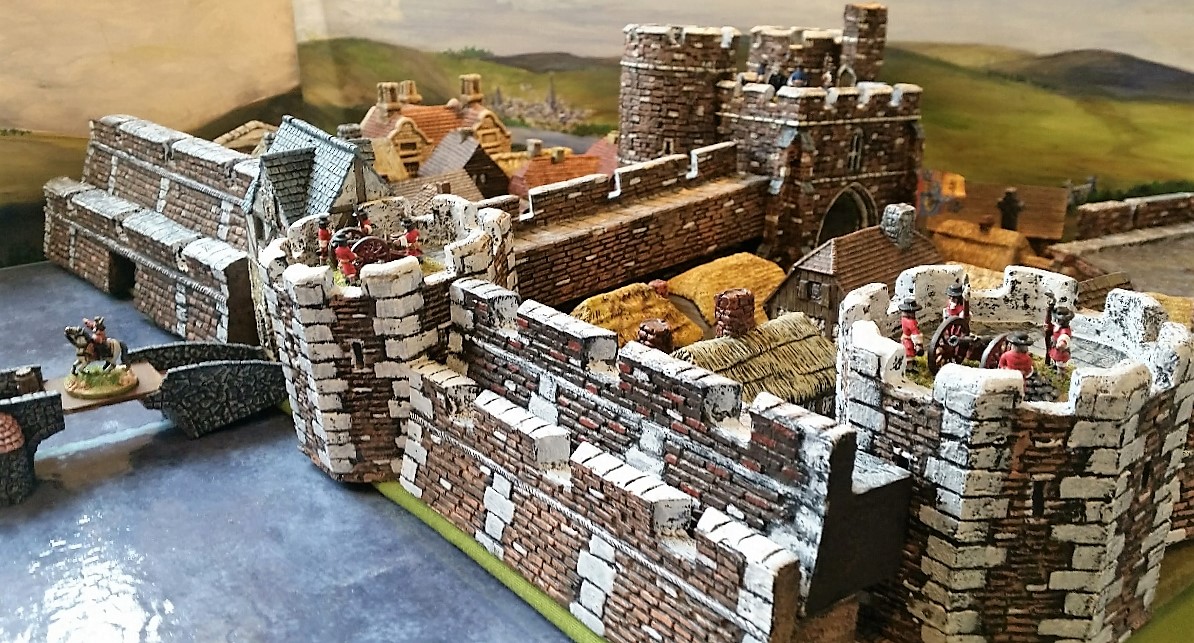
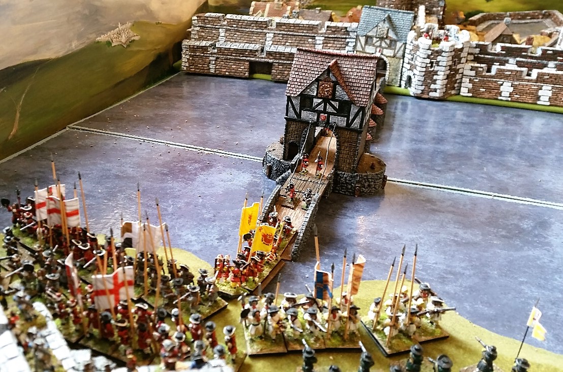
There is also a striking diorama in approx. 1/72nd
scale that features the disastrous fight on the Thomond bridge. The Allies
having marched round through the night into County Clare launched an attack on
the defensive ramparts that guarded the entrance to the bridge. From his
position of safety back on the castle walls, the French commander panicked;
ordered the drawbridge on the small gateway built onto the bridge to be raised.
This act condemned 100’s of Jacobite soldiers to a deadly fate – despite desperate
waving of white kerchiefs, the Jacobite colour, to signal their allegiance back
to the castle. They were ignored – and died either at the hands of the
similarly red-coated Williamites, or drowned in the surging waters of the
Shannon.
This awful incident is well-captured in the model shown
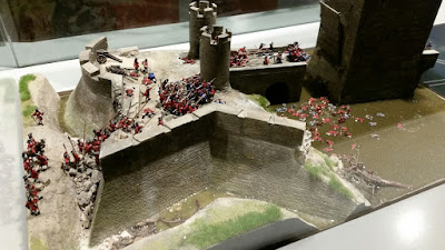
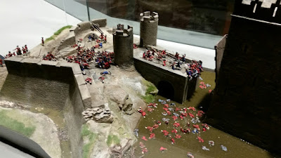
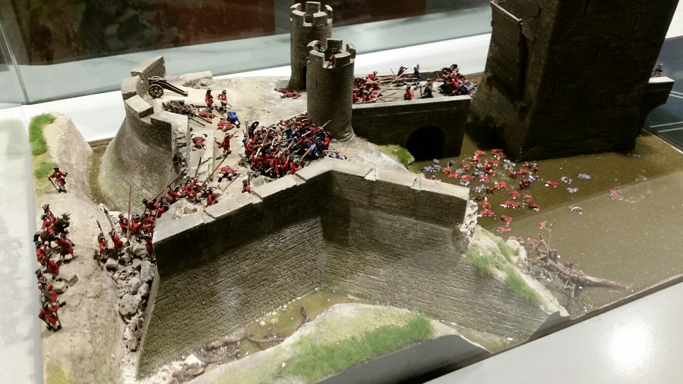
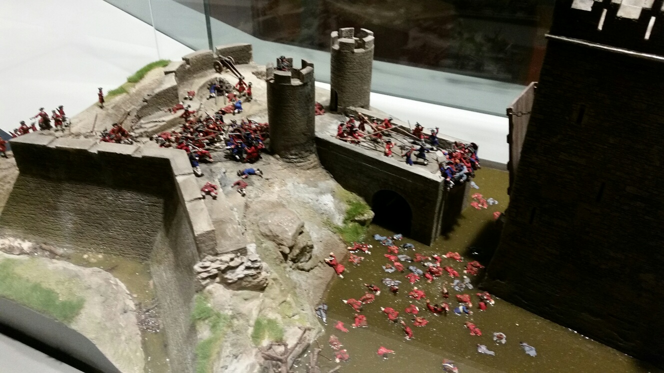
The
fight on the Thomond Bridge
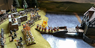
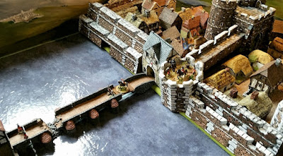
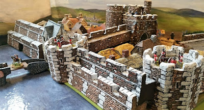
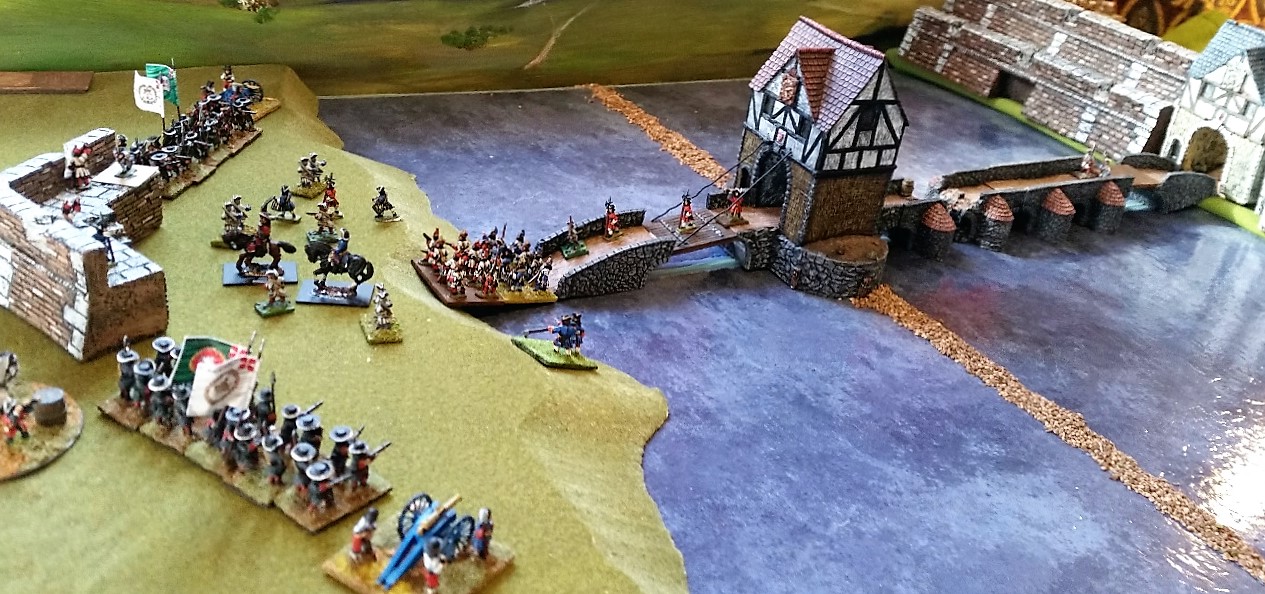
Inspired by this scene, I attempted to replicate it back on
my painting desk, using 15mm figures, buildings and river bases that were to
hand
Images 11, 12 ,13 –
views of Thomond, Limerick and the Shannon in 15mm


Here is that same bridge today – with the white water racing
through the arches, illustrating the speed and relentless nature of the river –
literally it took no prisoners…
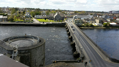

Looking West towards County Clare directly across the river
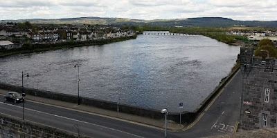

Two views looking north to the surrounding ring
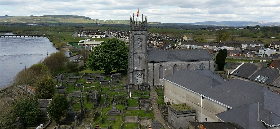
of hills with their patchwork woods in various shades of green and the church
of St Munchin – grey slate and grey tombstones – a bricked up/ blocked up sad
place – awaiting reclamation as an arts or cultural centre
2 modernized illustrations from Thomas Phillips drawings
made in 1685. Very useful wargaming material. These show the city in prospect
as it may have appeared to the Williamite army from their trenches – as the
bombarding of the 24 pounders and mortars rained down fire upon the houses…


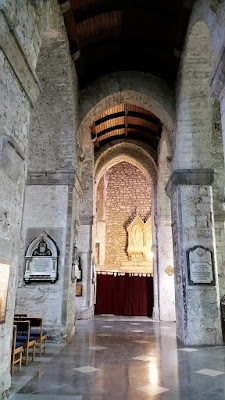
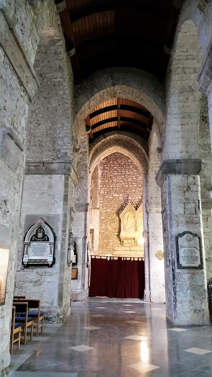
A view of St Marys cathedral interior – one of the oldest
churches in Ireland – it suffered much damage during the Williamite siege

Inscription on the treaty stone
Treaty stone itself
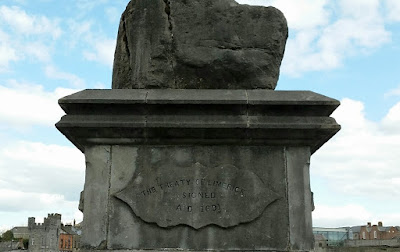
it all ended here – and then the new ventures began…

it all ended here – and then the new ventures began…