I have been researching how to bring this important campaign to the table top for a while now. That activity has paid off. I originally planned to build the entire river in 1/2400 which would have been a mammoth task however, I have now identified five important stretches:
1.The Mouth/Sheerness
2. Musselbank
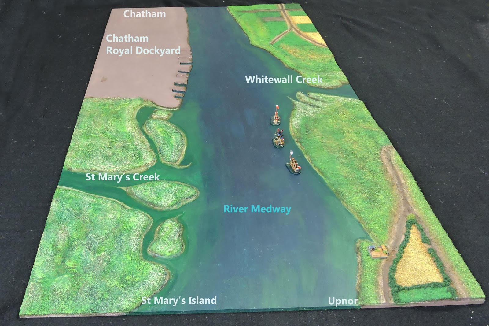
3. Gillingham Reach and St Mary's Creek
4. The Chatham Dockyard stretch
5. Chatham to Rochester Bridge
 |
| The river complete from The Dutch in the Medway- P.G. Rogers |
Action of some sort or another took place at each. Studying old maps, contemporary sketches and very importantly, Google Maps gave me a good feel for what I needed to achieve in recreating the terrain.
 |
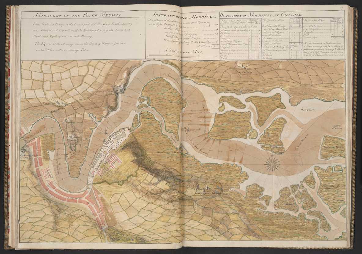
| My first challenge - to build the Chatham stretch to look like this |
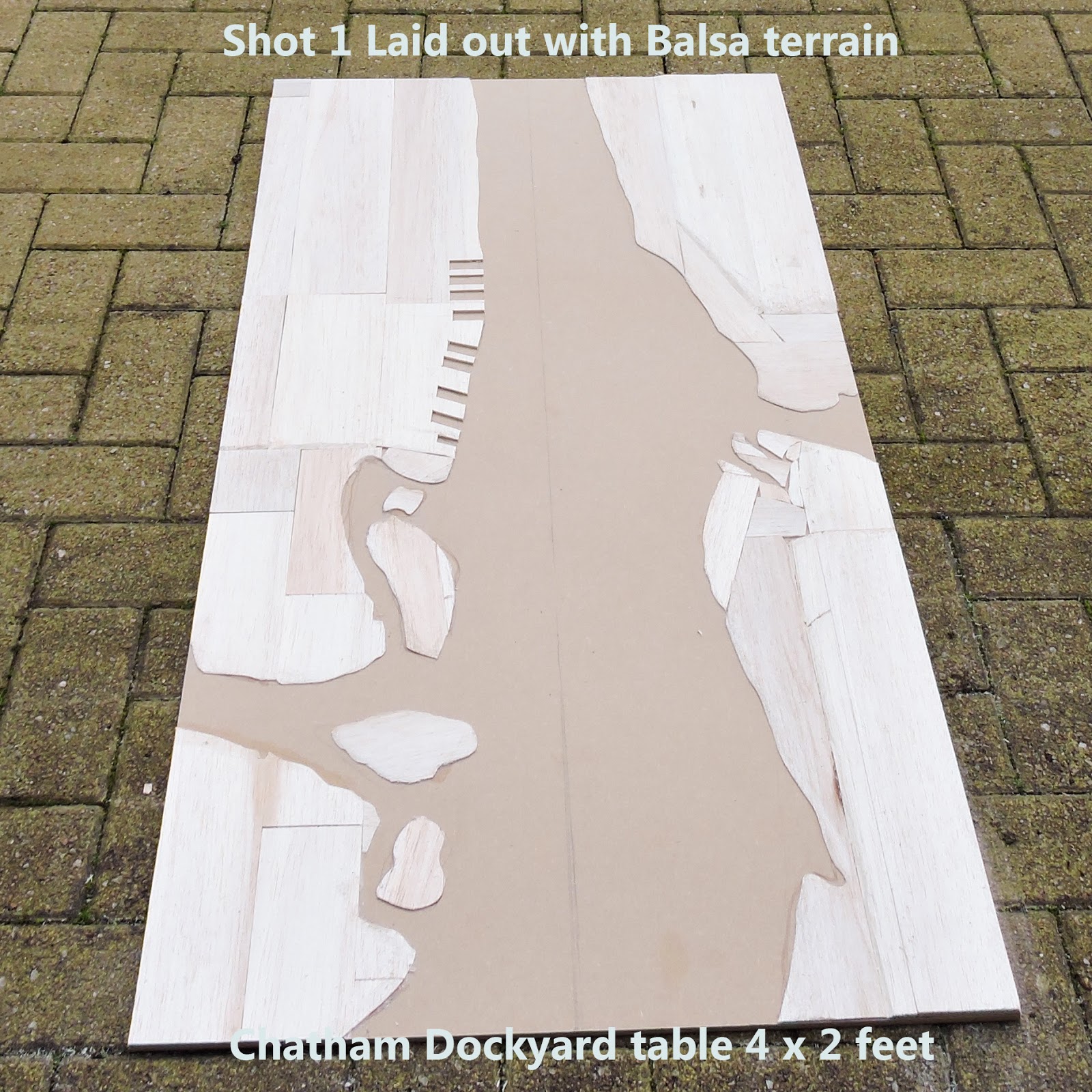
As per usual, my plan was more in my head than on paper. I bought some 6mm and 9mm thick MDF from the DIY store and decided to do a 2' x 4' test board which is what the piece features. I bought but dismissed various materials to represent the land , the most hopeful being 25mm thick polystyrene. In the end, it just didn't look like it would do the job.
Whilst head scratching in my workshop, a pile of unused balsa sheet caught my eye - hang on, that might just do it! And so, the project kicked off. I worked from maps to recreate a one mile (roughly four feet) stretch of the river between Upnor and Chatham. I drew a centre line down the board and made all of my calculations from that. I paid particular attention to the width of the river at the various points on the board.
 |
| Wonderful old drawing of the river showing the navigable channels |
As can be seen from the photos this paid dividends. At its widest it is probably between 1,300 and 1,450 feet with the exception of the mouth of Whitewall Creek. At its narrowest, about 700 feet. I worked on a ship's length being circa 120 feet for a 2nd rate meaning, the river would be between six and twelve ship's lengths wide.
 |
| Peter A's excellent shot from Upnor Castle looking at Upnor Reach |
The balsa cutting and shaping took about three hours on Friday night. Even at the early stages I could see it was going to work. Balsa is so easy to work with and on Saturday morning I plastered then sanded all of the land area. This took about 100 minutes. I decided to add another layer of height south of Upnor equivalent to about an extra 30-40mm.
 |
| Made by cutting out varying thicknesses of thin balsa sheet to get the river course (looking south) |
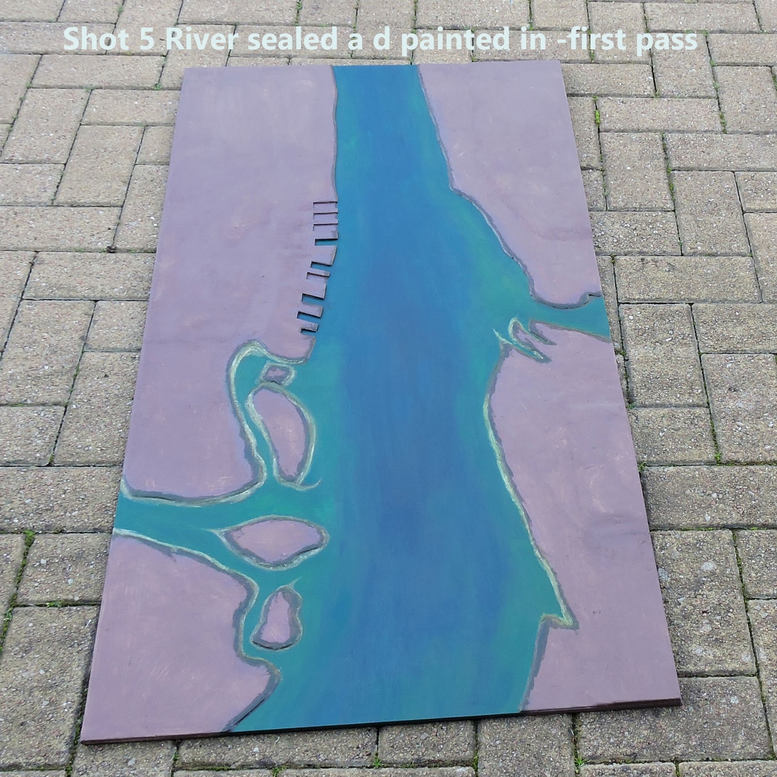
I sealed the river section of the board by first erasing the centre line and then using undiluted PVA glue to coat it. I then undercoated the land section using brown household emulsion paint.
 |
| Same set up looking north. Watch for the cut outs disappearing when it is plastered |
Now the exciting stuff began - I painted the river working from the deeper central channel outward to the shallows and the intricate shapes around the little islands and creeks. Painting the river took around another 100 minutes. The warm afternoon helped the air dry the paint fairly quickly.
 |
| A multitude of sins have disappeared with a thorough coat of plaster. |
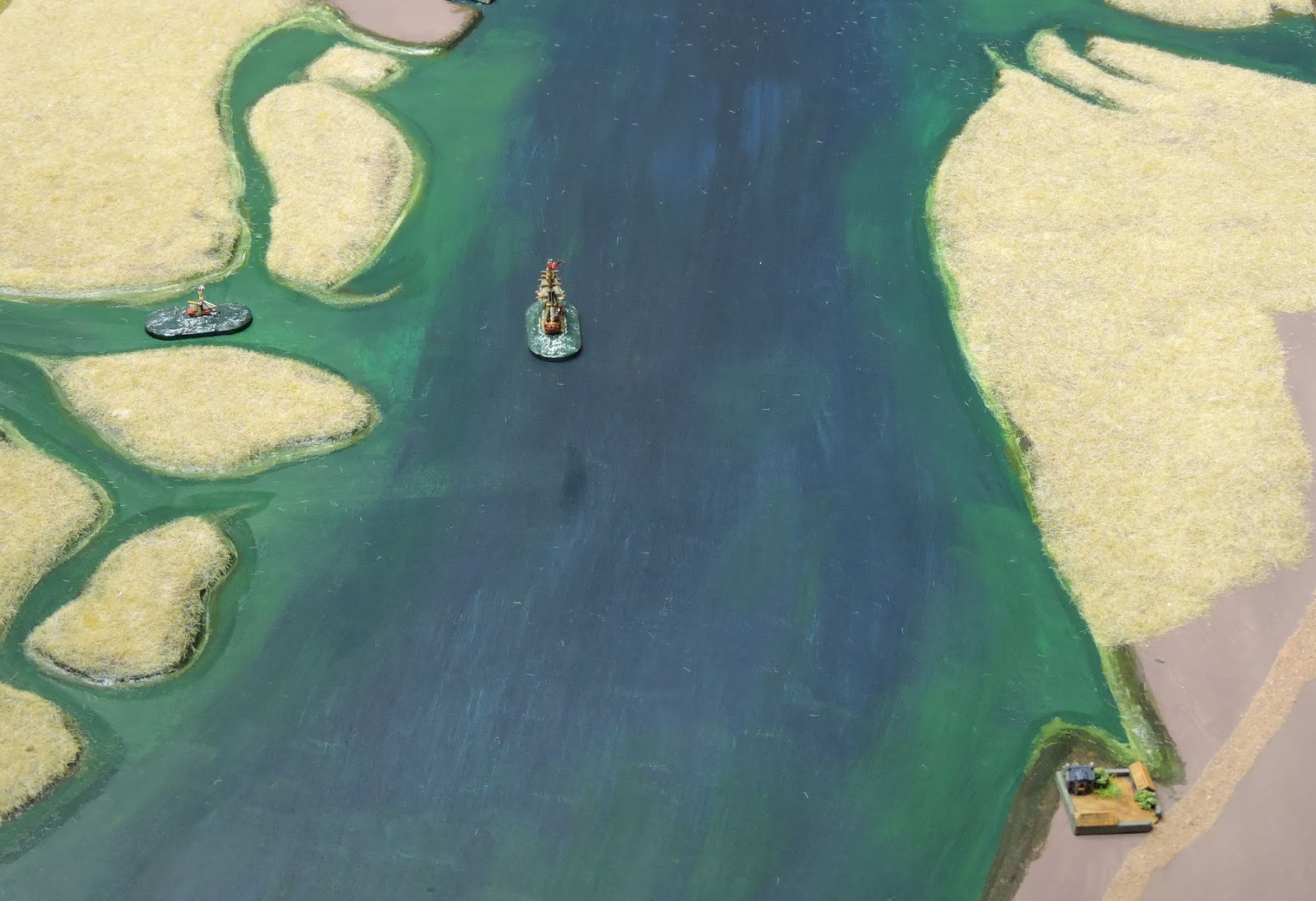
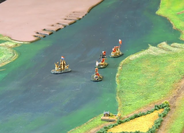
Getting into early evening I needed a little encouragement and placed a few ship models on the table to see if it looked the way I wanted it. I was pleased as the scaling seemed right. There is a tricky combo going on between 1/1200 and 1/2400 although it wouldn't be obvious until buildings in the former scale started to appear.
 |
| Household emulsion over the land area |
Heartened by the progress, I did a little more before stopping for the evening. I began to apply static grass using PVA. The material colour is irrelevant as the grass fibres were going to be undercoated in dark brown paint to seal them before being painted up using dry brushing.
 |
| Now the creativity really gets underway - the Medway painted in acrylics - six different colours blended |
x
 |
| Up for a perspective - land still naked but ships give a nice perspective |
I completed about half of the land and finished off the remainder on Sunday morning. Having left it to dry I was able to undercoat it in brown in about 30 minutes leaving that to dry whilst I got on with something else.
 |
| Putting the static grass down on the land - building in the bottom right to add perspective |
I returned to dry brush around 6pm. I wanted the marshlands at St Mary's Island to look different from other rough ground and the cultivated land to the west bank to have more defined crop colours, field shapes and boundaries. For now, I am ignoring the Royal Dockyard and Chatham itself.
 |
| Static grass undercoated in dark brown acrylic - locks it down and provides a deep base of colour to build from |
The groundwork was somewhat experimental but overall, I got the effect I was looking for. Roads and tracks had been laid in using fine building sand. I painted some fields leaving plenty of space for field boundaries hedgerows, trees and verges to go in later.
 |
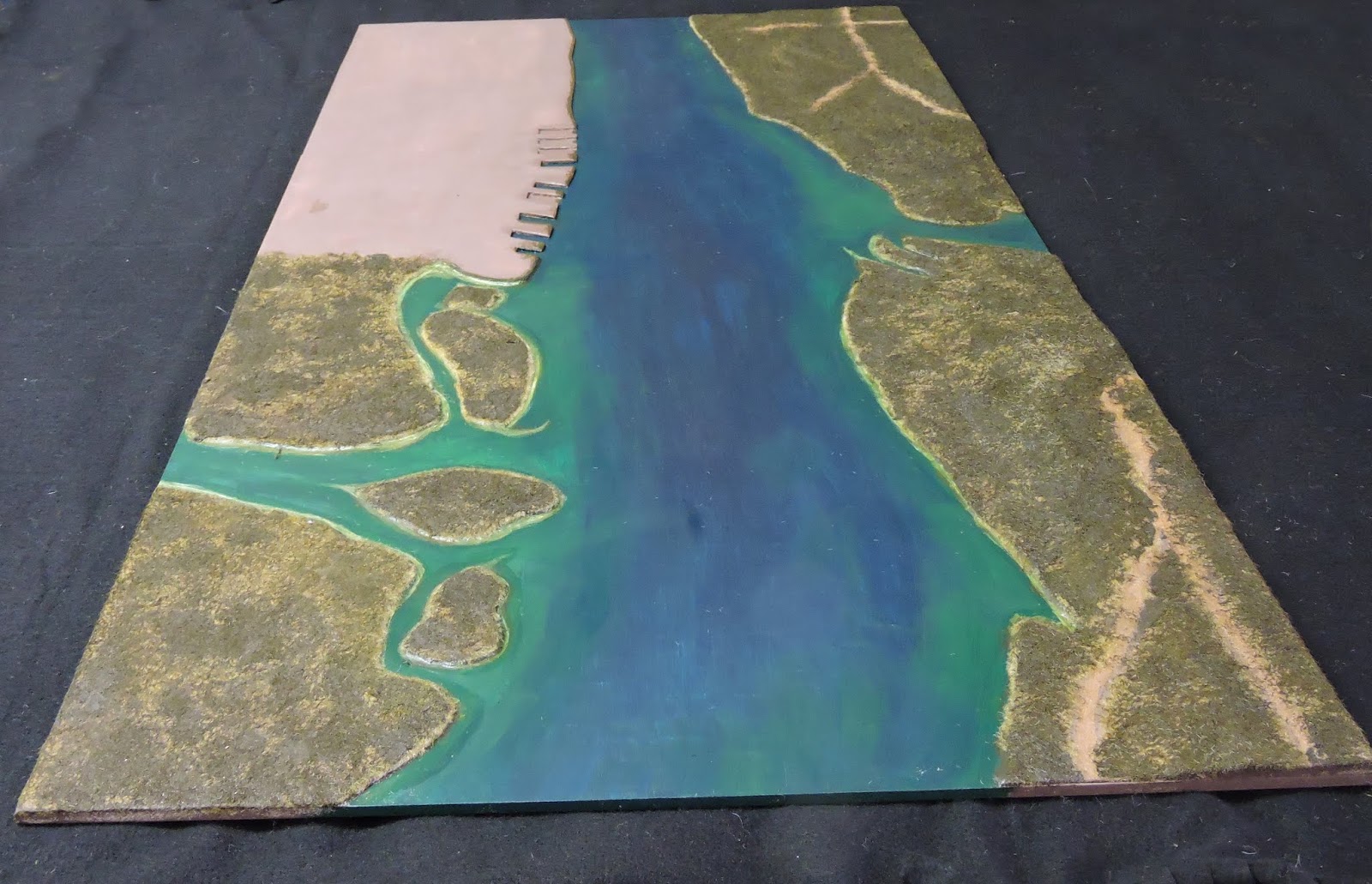
| Can you see what it is yet? It's starting to look like what I saw in my head |
By 1945 hours Sunday I had spent in total about ten hours on it and was seeing the project come together very nicely. It was clear that a final painting of the river was going to be the last step before varnishing the water.
 |
| Still lots to do with the land in terms of foliage and detail but it's getting there. |
I had to leave the project Sunday evening for a couple of days but it is going very well as can be seen from the accompanying shots.
 |
| Looking across St Mary's Creek to the anchorage |
 |
| Are you getting the idea? |